miyanoura
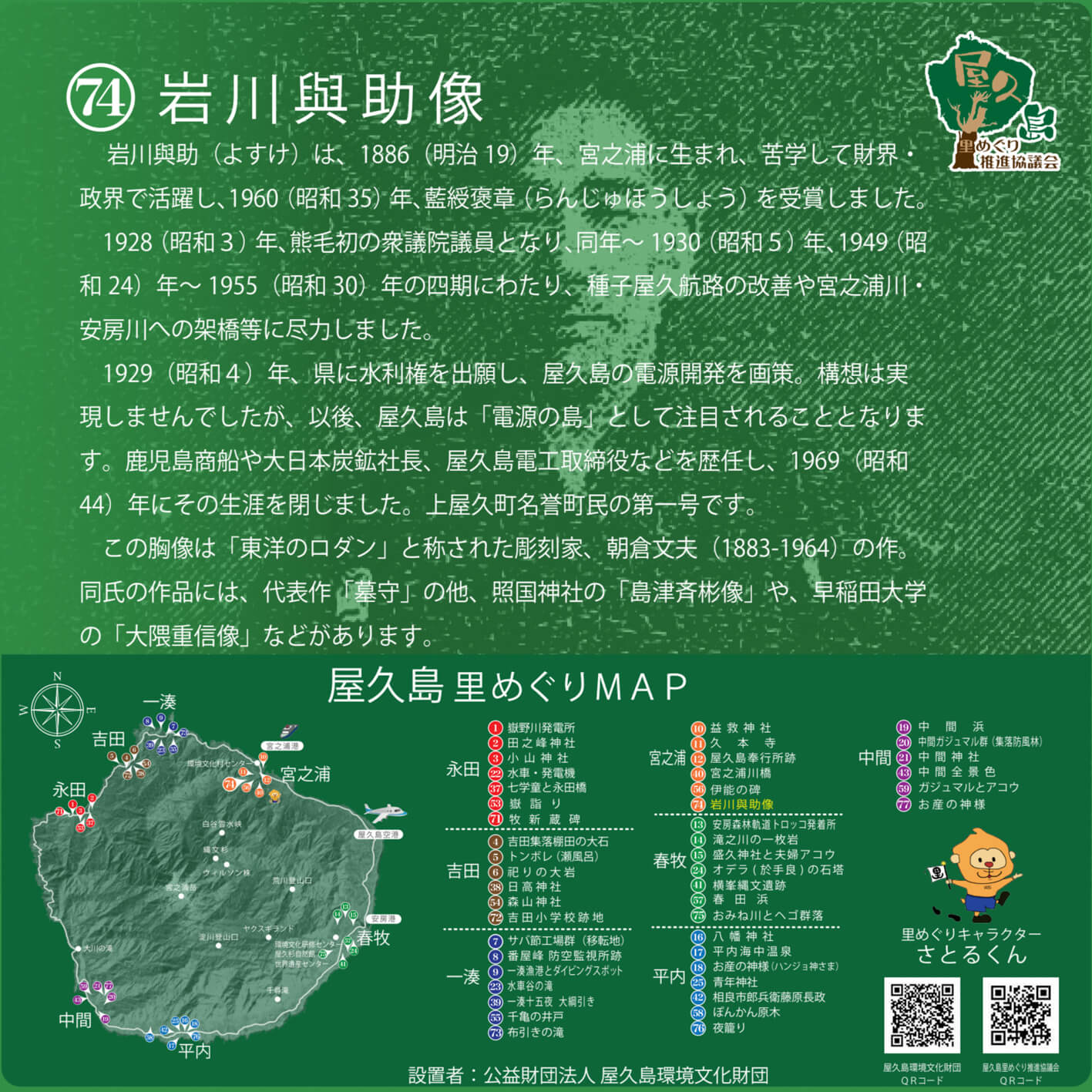
Statue of Iwakawa Yosuke
- Modification: 2024/01/11
- Area: miyanoura
Iwakawa Yosuke was born in Miyanoura in 1886 (Meiji 19), put himself through school, and subsequently flourished in the political and economic world. In 1960 (Shōwa 35), he received the blue-ribbon Ranjuhōshō, or the Japanese Medal of Honor, which is awarded to those who have made significant contributions in the realm of public welfare or public service.
In 1928 (Shōwa 3), Iwakawa became the first member of the Lower House of Parliament from Kumage (the administrative region of Yakushima and Tanegashima), and served four terms during the periods of 1928–1930, and 1949-1955 (Shōwa 30). He accomplished both the revitalization of shipping routes to Tanegashima and Yakushima, as well as the completion of bridges across the Miyanoura and Anbo Rivers on Yakushima.
In 1929 (Shōwa 4), he appealed to the prefectural government for local water rights, and drew up plans for Yakushima’s hydroelectric development. His vision didn’t come to fruition, but later, Yakushima drew wider attention as its potential as an “island of electricity.” Iwakawa adopted several successive professional roles, including company director and board member, and in 1969 (Shōwa 44) he passed away. His prestige and accomplishments remain a historical source of pride for Kamiyaku, or the northern half of Yakushima island.
This bust was created by Fumio Asakura (1883–1964), who was known as the “Rodin of the East.” Asakura is known for his works such as “Cemetery Keeper” (Hakamamori), the statue of Shimadzu Nariakiya at Terukuni Shrine in Kagoshima City, and the statue of Shigenobu Ōkuma at Waseda University.
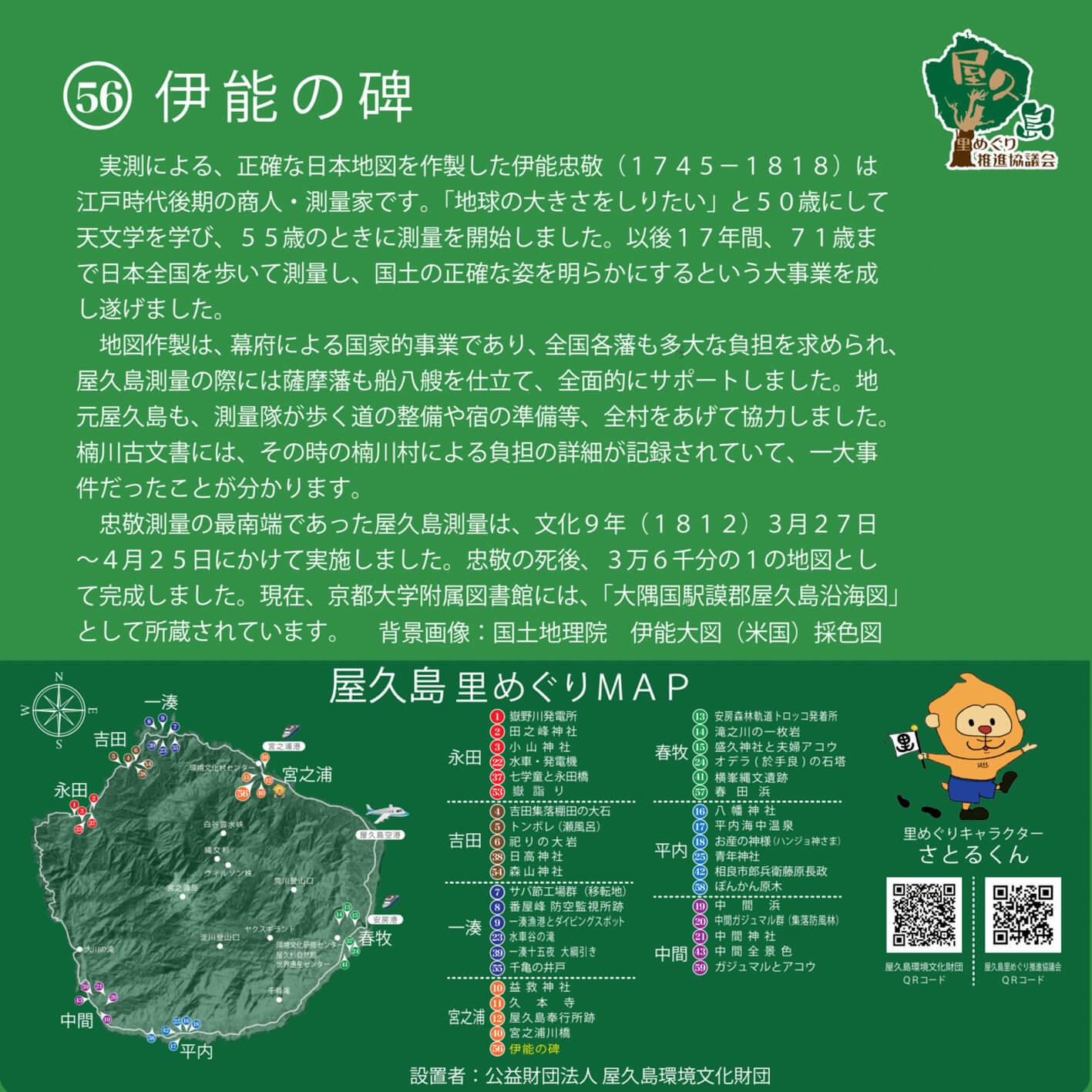
Inō no Hi (Inō’s Tombstone)
- Modification: 2024/01/11
- Area: miyanoura
Tadataka Inō (1745–1818), the man who created the most accurate-to-scale map of Japan of his age, was a merchant and surveyor during the latter days of the Edo period.
“I want to know the size of the Earth,” he declared, and at the age of 50 began to study astronomy. At 55, he began his work as a surveyor and cartographer. For the next 17 years, he traversed Japan by foot, taking precise measurements and painting a clear picture of Japan’s landscape and geography. At the age of 71, he finally completed this monumental task.
The creation of his map was a state project, sponsored by the Tokugawa Shogunate. The burden of this project also fell onto regional feudal domains. During Inō’s survey of Yakushima, for example, the Satsuma clan deployed eight ships to support his cartographic efforts. The community of the island also mobilised, clearing paths and roads for the surveying team as well as preparing its food and accommodation.
Details of this project are recorded in Kusugawa Village’s ancient archives—apparently, it was quite a large-scale affair.
Yakushima was, in fact, the southernmost reach of Inō’s national survey. He spent approximately one month between March 27 and April 25, 1812 (Bunka 9), on the island. The map of Yakushima, which was one of 36,000 from Inō’s survey, was completed after his death. This map is currently on display at Kyoto University Library as Ōsuminokuni Gomugun Yakushima Enkaisenzu.
(Background image: Watercolor Inō Map, Geospatial Information Authority of Japan)
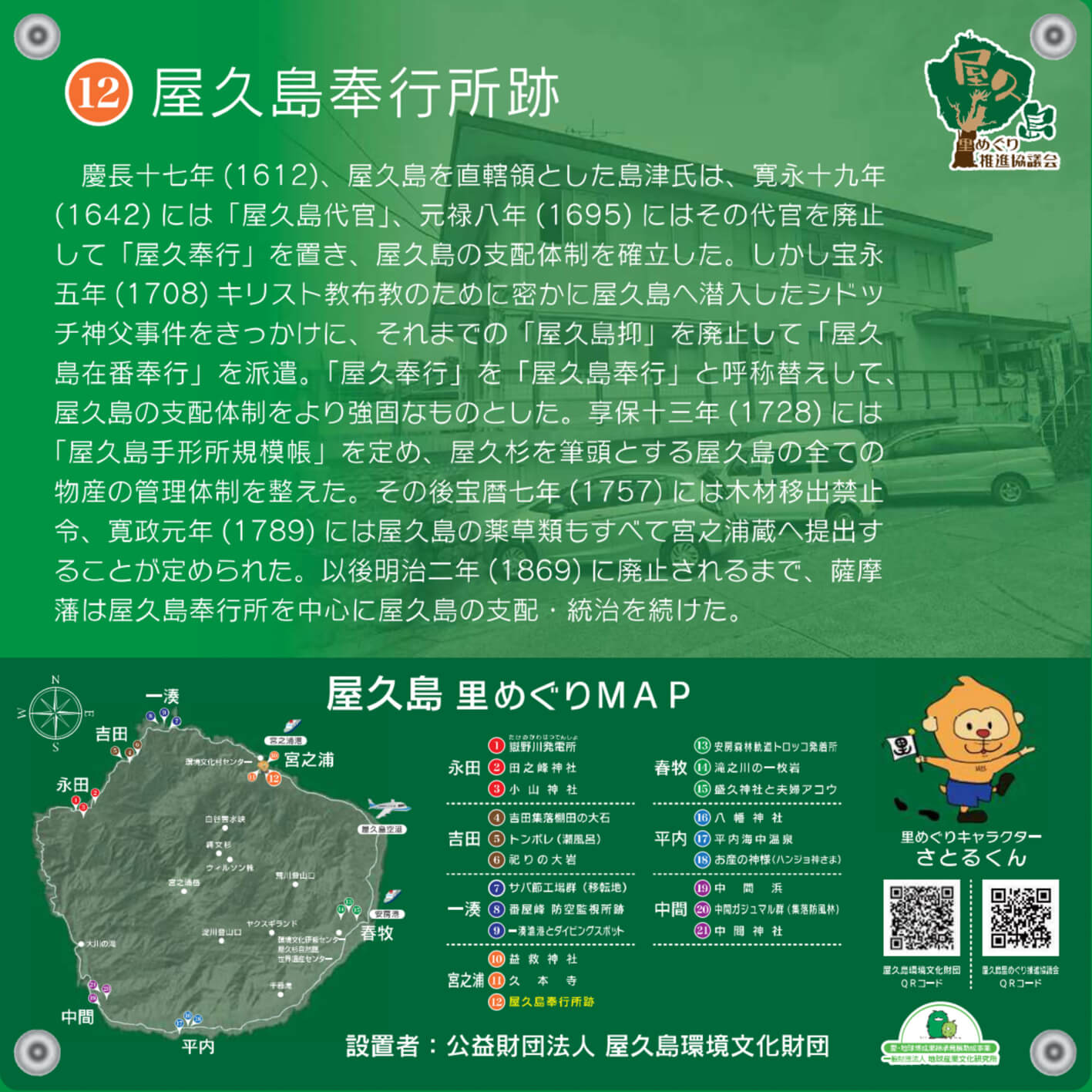
Yakushima Magistrate’s Office Ruins
- Modification: 2024/01/11
- Area: miyanoura
In 1612 (Keichō 17), a man named Shimadzu was the sole ruler of Yakushima. Thirty years later in 1642 (Kanei 19), he assumed the office of Yakushima Daikan. Daikan was a local administrative post, often hereditary, under the jurisdiction of the regional Shōgun. In 1695 (Genroku 8), the office of Yakushima Daikan was repealed, and was instead replaced by the bureaucratic office of Yaku Bugyō, or Yakushima magistrate.
However, upon the 1708 (Hōei 5) incident of Italian Christian priest Shidocchi making his (illegal) entry to Japan via Yakushima, the office of Yaku Bugyō was changed to Yakushima Bugyō, and the island’s government was thus established as the Yakushima Magistrate Office.
In 1728 (Kyōhō 13), the Yakushima Tegatajo Kibochō system of laws and rules was established, creating an organisational structure for all of Yakushima’s industries. In 1757 (Hōreki 7), the export of lumber was prohibited, and in 1789 (Kansei 1), it was decided that all of Yakushima’s medicinal herbs would be put into storage at a storage facility in Miyanoura. Thereafter and until its demise in 1869, the Satsuma Domain continued the use of the Yakushima Magistrate’s Office as base of operations for the rule over and administration of Yakushima.


※ツアーは、電話・FAX・メールでお申込み頂けます。


![]()
![]()

〒891-4205
鹿児島県熊毛郡屋久島町宮之浦823番地1
TEL:0997-42-2900
FAX:0997-49-1018
(屋久島環境文化村センター内)